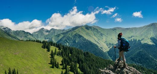
Top 5 Best Hikes in Hoh Rainforest
by Sean B ·
This page may contain affiliate links. For more information, see our "About Us" page.
Top 5 Best Hikes in Hoh Rainforest

The Hoh Rainforest is located on the west side of Olympic National Park in Washington State. Situated along the Hoh River valley, formed by glaciers many years ago, this forest is one of the largest temperate rainforests in the United States. You’ll find Sitka spruce, western hemlock, Douglas fir, cedar, maple, alder and cottonwood. Adding to the greenery is a variety of mosses, lichens and ferns. Wildlife abounds, including black bears, deer, elk, raccoons, cougars, frogs, owls and more. While the area west of the park border has been logged, once you cross the park boundary you’ll find a well-preserved area that contains a plethora of hiking trails, which allow you to explore everything the area has to offer. Everything from short loops to longer, multi-day hikes are possible. Today we’ll be taking a look at the top 5 best hikes in Hoh Rainforest.
1. Spruce Nature Trail / Hall Of Moss
Starting off our list of best hikes in Hoh Rainforest, we’ll begin with the shortest hikes and work our way towards the longer hikes later in this article. At the Hoh Rain Forest Visitor Center you’ll find two short loop hikes – they’re popular due to their close proximity, relatively small elevation gain, and abundant scenery. The Spruce Nature Trail is a nice 1.2 mile loop hike that allows you to take in views of old growth trees, the Hoh River, and even wildlife, everything from banana slugs to even elk if you’re lucky. The Hall Of Moss trail is great too, with huge old-growth trees, ferns and of course, mosses! This one is about the same length – approximately 1.1 miles. Due to the popularity of both trails, it’s not a bad idea to visit this area on a weekday, or during the early morning or evening hours. While camping is not allowed on this loop, there is a nice campground at the trailhead.
Total Loop Distance 1.2 miles (Spruce Nature Trail) / 1.1 miles (Hall Of Moss Trail)

2. Hoh River Trail
While this out and back trail is a total length of approximately 33 miles, this is a great hike even if you go in a few miles, then back out. Also, there are several campsites along the way so if you’re determined to make it all the way to the end it’s easily done by spending a night or two along the trail. The trail is pretty flat most of the way, as it follows the Hoh River Valley for the first 12 ½ miles or so. As you move through the forest, take in the enormous old growth trees and green moss – at times you’ll savor total silence, save for the occasional sound of birds or falling leaves.
If you are a beginning backpacker, this hike is absolutely perfect, as there is very little elevation gain and there are places to camp at 2.25 miles (Mount Tom Creek), 5 miles (the appropriately named Five Mile Creek), 6 miles (Happy Four), and 9 miles (Olympus Guard Station). Going a bit further, there are camp sites found along the shore of Elk Lake, which is just over 15 miles each direction.
If you decide to go all the way to the end you’ll be rewarded mightily by the views of Blue Glacier, one of the largest glaciers on Mount Olympus (elevation 7,980 feet). To get there, you’ll not only have conquered a climb of nearly 4,000 feet over 4 miles, but also a somewhat sketchy wood and rope ladder that goes up a large washout towards the end of the hike (affectionately known as the “Ladder Of Doom”. If you are afraid of heights, or are simply afraid of ladders, reaching the end of this hike will be out of the question, and unfortunately you’ll miss out on the best views this hike has to offer.
Total Distance: 33.0 miles
3. Hoh Lake Trail
This trail is a great alternative if you don’t want to do the dreaded Ladder Of Doom towards the end of the Hoh River Trail. To reach Hoh Lake, you basically take the Hoh River Trail from the visitor center trailhead 10 miles until you reach the Hoh Lake Junction (it’s just past the Olympus Guard Station. From there you will head up – or should I say UP. You’ll gain nearly 3,500 feet as you hike 5 miles, with lots and lots of switchbacks taking you up through the forested slopes of Bogachiel Peak. Once you reach the lake you’ll be within the Seven Lakes Basin, where you will need advance reservations and a permit to camp. It’s worth the effort, as you’ll have a chance to enjoy a beautiful, sparkling lake and the surrounding mountains.
If you hit it right, you’ll see avalanche lilies and other subalpine species of plants and wildflowers in bloom. Like other campsites in the area, make sure you have a bear can and are “bear-aware” – elk can also be seen in the area. There is a composting toilet at the camp, should the need arise. It’s also a good idea to carry plenty of water – the trail passes through an area where there was a large fire in the late 70’s so there is little shade through this stretch. If you are a “peakbagger” it’s only another mile and 600 feet of elevation gain to reach the top of Bogachiel Peak, where you’ll enjoy nice views of the interior Olympics.
Total Distance: 29.0 miles
4. South Fork Hoh River Trail
This trail doesn’t get nearly the attention that the trails from the Hoh Rain Forest Visitor Center trailhead gets – to be honest the trail isn’t nearly as spectacular, and doesn’t feature alpine or glacier views. However, this means there is very little foot traffic, so at times you may have this trail to yourself. To get to the trailhead you’ll have to travel on a gravel road, passing the South Fork DNR campground, before reaching the trailhead, which is just outside the National Park. You’ll want to use caution in this area, as bears are often sighted – if you don’t actually see a bear there’s a fair chance you’ll at least see a pile of bear scat along the trail.
The trail begins outside the park, so the Sitka spruce you see initially is second-growth, as this area was logged nearly 100 years ago. Once you enter the park, roughly a half mile into the hike, you’ll suddenly be immersed into old growth forest – including enormous Douglas fir trees with trunks over 10 feet thick. After a mile you’ll enter what’s called the “Big Flat”, site of a glacier long, long ago which is now a river valley often socked in with fog. At 1.3 miles you’ll find the Big Flat campsite – continuing on through a forest full of tall spruce and green moss. Unfortunately, since this trail isn’t as popular as others in the park it doesn’t get as much love – you’ll eventually reach a point where the trail disappears into a mess of large boulders, fallen trees, and undergrowth that hasn’t been cut back in years. The total distance of 8.5 miles round-trip is measured by where most people turn around on this hike.
Total Distance: 8.5 miles

5. Snider - Jackson Traverse Trail
Also known as the Hoh-Bogi Trail, this little-used trail connects the road leading to the Hoh Rain Forest Visitor Center and the Bogachiel Trail (which is part of the Pacific Northwest National Scenic Trail, which stretches over 1,200 miles between Glacier National Park and the Washington coast.) This trail is not for the casual hiker – it’s an up and down trail that starts at about 700 feet and goes up to nearly 3,300 feet, before going back down to 500 feet. It starts off easy though – as you leave the Hoh-Bogachiel trailhead you’ll be in the flat Hoh River valley. However, the situation changes in about half a mile as you begin to climb up a series of switchbacks.
Once up the switchbacks you’ll continue climbing, following a ridgeline for a few miles. Once you reach the crest then you’ll start a slow, steady descent towards the Bogachiel River. You’ll reach a junction less than a mile before you reach the river – take a right and you can follow a relatively short trail to the Flapjack campsite. While situated next to the river, these campsites are fairly overgrown with grasses and brush so unless you like primitive camping this site isn’t the best. For an overnighter it’s worth not taking the detour – a better spot to camp is the Bogachiel camp, which is just a couple of miles away on the main trail. The Bogachiel camp is at the junction of the Snider-Jackson Traverse Trail and the Pacific Northwest Trail / Bogachiel River Trail. Since it sees more traffic the campsites are in better condition (although still primitive and just lightly maintained)
If you have two vehicles, this can be done as a one-way hike, starting at the Hoh-Bogachiel trailhead, then connecting with the Bogachiel Trail and head west to the Bogachiel trailhead (where you can have leave a second car or have someone pick you up). Total distance of this option is about 21 miles.
Total Distance: 22 miles
Top 5 Best Hikes in Hoh Rainforest - Conclusion
Inhabited by a wide variety of foliage and wildlife, as you can see Hoh Rainforest also plays host to some of the best hikes around. With such a plethora of hiking options to choose from, you’re sure to find something that fits your preferences. Ranking among the largest temperate rainforests in the United States, Hoh is definitely worth the trip. If you’re looking for more backpacking destinations, consider reading our article “5 of the Best Backcountry Hikes in Yellowstone“. Safe adventures and happy travels!